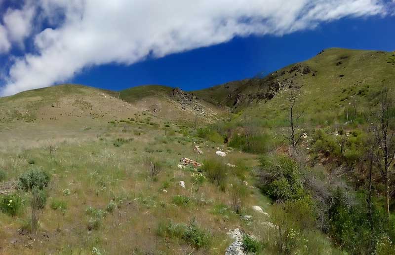
(May 11, 2019 / Author: Tim Bondy) Granite Mountain is located above the South Fork of the Boise River and about 10 miles east of the town of Prairie, Idaho. I’ve attempted to summit this peak three previous times in the past few years and haven’t really gotten close. On this 09 May 2019 Granite Mountain hike, I again failed but I’m cool with that fact because it’s a strenuous route and the weather shut me down.
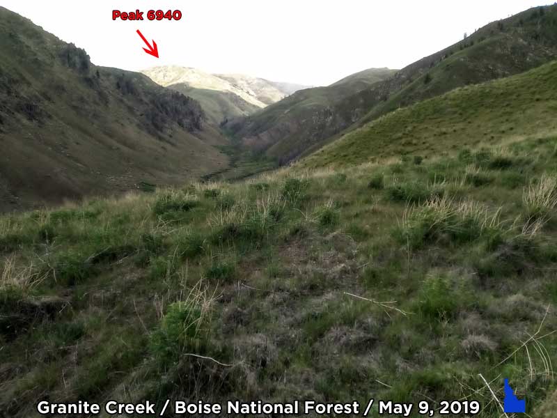
Featured Image Info: Granite Creek with Peak 6940 in distance /// 43.382214, -115.534462 /// https://photos.app.goo.gl/wrdQ6WZwNq6i76nS9
There a few different routes a hiker can take to summit Granite Mountain. The route I’ve been tromping up seems like the best possible way to me. I may give other routes a try in the future if I fail a few more time on this tried and true “ridge to ridge to ridge” hike.
If you use the coordinates of my stated trailhead and the summit coordinates you should be able to piece my route together. If not, I’ll be glad to accompany the right individual. Please realize the Granite Mountain is depicted in different places on different maps … Even on USGS topo maps. Discover your own peak location and give it a try.
Check the Weather Forecast?
On this trip, I was a little unprepared and didn’t fully research the forecasted weather. If I had, I would have attempted the hike anyway. Let’s just say all my usual weather models suggested I would see some showers in the area. During the drive from the tiny town of Mountain Home, Idaho to the trailhead it was pretty clear I’d be seeing some inclement weather.
After just 30 minutes of rather steep hiking, I could hear distant thunder and the skies looked rather menacing off to the northeast and east … Or the direction I was heading. The average lifespan of a thunderstorm is about 40 minutes so I figured it would dissipate rather soon. It didn’t.
The Thunderstorm Turned me Around
Long story, short, the thunder became near continuous, the winds picked up and hail, rain and ice pellets pelted me just as I pulled the jacket out of my backpack. Even with the jacket and gloves, it was pretty cold as I retreated down the mountain.
The thunderstorm moved off to the southwest leaving Granite Mountain in near cloud-free conditions. But by then, I had already descended down the mountain pretty darn far and I had no intentions of heading back up that way. But I will be heading up there in the next few weeks again.
“I normally do my research before a hike and weather is one of those items to always do right.” ~ Tim Bondy [afterthought]
Check the graphics at the end of this trip report. There is an animated radar depiction from a National Weather Service model. It clearly showed (to me, an ex-weatherman) there would be thunderstorms in the area of my hike. And hiking on high, unprotected ridgelines in a thunderstorm isn’t smart. That’s why I normally do my research.
Granite Mountain Hike Stats for the May 9, 2019 Trip
- Adventure Date: May 9, 2019
- Consider Doing it Again?: Yes
- Trailhead: 43.384007, -115.543614
- Turn-Around Point or Furthest Out Point: 43.378438, -115.524291
- 7.5 Topo Maps: Mainly Cathedral Rocks, Long Tom Reservoir. A small portion of the hike could be on the House Mountain, Anderson Ranch Dam
- Trail/Road #: Trailhead is near the intersection of FSR #121 and Spur #121R
- Mountain Range(s) Involved: Fall Creek Mountains (Self-named)
- Health of Local Environment – [Excellent / Good / Fair / Bad / Horrible]: Fair, but there is a lot of invasive weeds starting to emerge
- Land Ownership: 100% Boise National Forest public lands.
- Wildlife: Coyote, fox, and many raptor-type birds.
- Mileage: 2.64 miles
- +Vertical Feet: 1,589 feet
- Time from Trailhead to Trailhead: 2:59 hours
- Trailhead Temperature: 52F -59F
- Avg Slope from Google Earth Vertical Profile of the GPX File: 22.8%
- Google Photo Album Link: https://photos.app.goo.gl/jgPpgMTapyzCr9sU9
- Google Earth KMZ: SOUTH FORK – Hike – Granite Peak Attempt (local file only)
- GPX File Name: 20190509-122843.gpx (local file only)
- Driving Time to Trailhead: 50 minutes
- Granite Mountain (6,818 feet): 43.375007, -115.499462
Forecast Radar Imagery

This story was originally published on May 11, 2019.
Thanks,
~ signed ~
Tim Bondy
Freelance Writer & Citizen Journalist