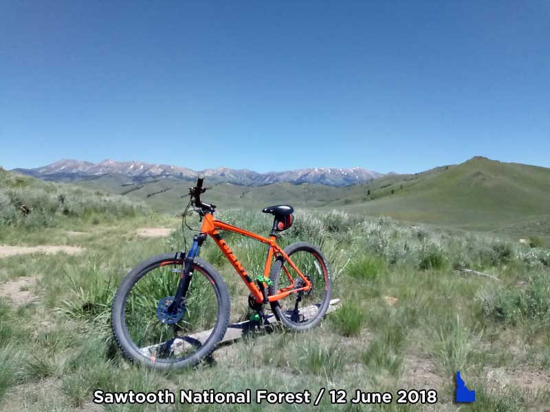
(May 9, 2019 / Author: Tim Bondy) This June 12, 2018, mountain bike ride on the fire roads and trails of the Sawtooth National Forest provided for some excellent scenery, strenuous hill climbs and a promise to return for more adventures in this area.
Featured Image Info: 43.412647, -115.106987 // https://photos.google.com/photo/AF1QipNH4ZddkeVusX2vR3_MIQYb91QaS08pzPOdDGjK
For the most part and ironically, this Sawtooth National Forest mountain biking trip is in a treeless environment except along the various streambeds you’ll encounter. The fire roads ranged from groomed to very rocky and rutted. The trails I rode ranged from doubletrack to barely a cow trail.
My goal on most adventures is to minimize the amount of dirt road I drive my vehicle on while maximizing solitude and scenery during the adventure part of the trip. By choosing a trailhead at 43.399699, -115.193180, I ended up riding doubletracks I’d prefer to avoid but the scenery is still rather nice, however, the “ranching environment” with its cow patties is maximized.
Once I got to the Hawk Gulch doubletrack, the environment and riding became much more enjoyable. The trail continues east into the Sawtooth National Forest where it becomes more remote and even more scenic.
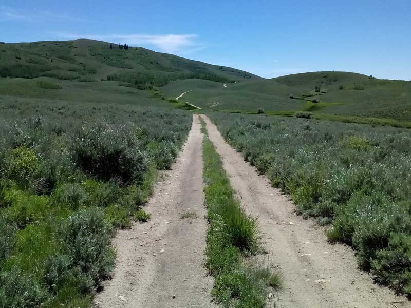
At the intersection of Hawk Gulch and a rustic trail that follows along Thompson Creek, the ride gets even better for a short distance. Slowly this portion of the trail peters out into game/cow trails that wanders hither and yon until even those peter out to no trail at all.
Research this area and make your own adventures in the Sawtooth National Forest. And when you do, let me know where you rode.
Hawk Gulch / Thompson Creek 12 June 2018 Ride Stats
- Adventure Date: June 12, 2018
- Consider Doing it Again?: Yes
- Trailhead: 43.399699, -115.193180
- Turn-Around Point or Furthest Out Point: 43.415565, -115.083173
- 7.5 Topo Maps: Sprout Mountain and Deer Mountain
- Trail/Road #: Trailhead FSR #181A, FSR #181, Hunters Creek, Hawk Gulch to trail following Thompson Creek and back to the trailhead in reverse.
- Mountain Range(s) Involved: Soldier Mountains (Self-defined)
- Health of Local Environment – [Excellent / Good / Fair / Bad / Horrible]: Good
- Land Ownership: 40% private property with legal public easement and 60% national forest service lands.
- Mileage: 14.8 miles
- +Vertical Feet: 1,845 feet
- Avg Slope from Google Earth Vertical Profile of the GPX File: 4.2%
- Google Photo Album Link: https://photos.app.goo.gl/7pH3VUswYHXAWo8y5
- Google Earth KMZ: CAMAS – Bike – Hunter Creek / Hawk Gulch Plus (local file only)
- GPX File Name: 20180612-123653.gpx (local file only)
- Driving Time to Trailhead: 55 minutes
Originally published elsewhere on June 13, 2018.
Edited and republished here on May 9, 2019.
Thanks,
~ signed ~
Tim Bondy
Freelance Writer & Citizen Journalist
“There should be two eras in every lifetime. One for mountain biking and the other for work.” Tim Bondy but inspired by Bernard Hinault