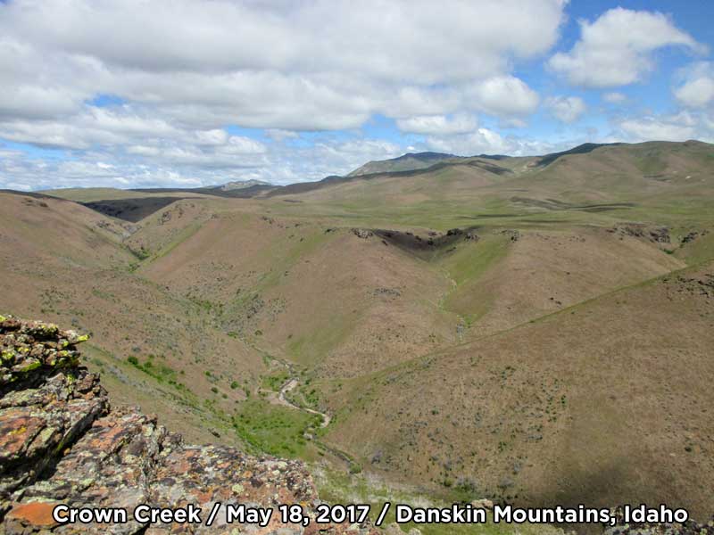
(May 19, 2019 / Author: Tim Bondy) Crown Creek is located in the Danskin Mountains of southwestern Idaho and on May 18, 2017, I hiked into this little stream to scout out the area for some trout fishing. I’ve never heard of anyone fishing this portion of the creek.
Featured Image Info: 43.349570, -115.703756 /// https://photos.app.goo.gl/873asdBNjqQvz1cSA /// Looking about 850 feet down into Crown Creek from the ridge just to the west of the creek.
Where, What and How – Crown Creek
The Hike in to Crown Creek
The trailhead for this hike is located on BLM land and one just needs to load up the daypack and head up the ridge to east. Then, just keep walking until you encounter the Crown Creek river valley. You’ll have to navigate the very steep slope down to the creek before choosing to explore either upstream or downstream. It’s that straightforward.
The hike back to the trailhead can go numerous ways. All of them involve a healthy climb out of the canyon. Take your time and enjoy the scenery as you head back to your vehicle.
FYI: Private property hems in the lower portions of Crown Creek and road access to the valley halfway to its headwaters. I had to get a little creative in finding a 100% public lands route access in there. But I did.
Alternate Routes in to Crown Creek Exist
“You can’t get to that public land because there is private property between our lands and their lands.”
Crown Creek Hike Stats
- Date Of Hike: May 18, 2017
- Name of Hike: Scouting For Trout in Crown Creek of Idaho’s Danskin Mountains
- Trailhead: 43.352793, -115.719223 on FSR #167
- Turnaround Point or Furthest Out Point: 43.347624, -115.699143
- Mountain Range(s) Involved: Danskin Mountains
- Link To Photographs: https://goo.gl/photos/zF5fBQHQA3PZx6gz8
- Mileage: 3.77 miles
- + Vertical Feet: 1,250 feet
- Average Slope: +10.4% / -11.6%
- Elevation Ranges: 4,142 feet / 4,816 feet
- 7.5 Topo Maps: Syrup Creek
- Hike Time: 3 hours 12 minutes
- Facilities At Trailhead: None
- Land Ownership: 98% BLM and 2% Idaho State Lands
- Rockhounding Potential: Zero
- GPX File Name: 20170518-124138.gpx (local file only)
- Road Mileage from Boise, Idaho to Trailhead: 45 miles
This story was originally published elsewhere on November 6, 2017. It was updated and republished on May 19, 2019.
Thanks,
Freelance Writer & Citizen Journalist
“My soul lives in the Mountain West … It’s where I fish for trout.” ~ Tim Bondy