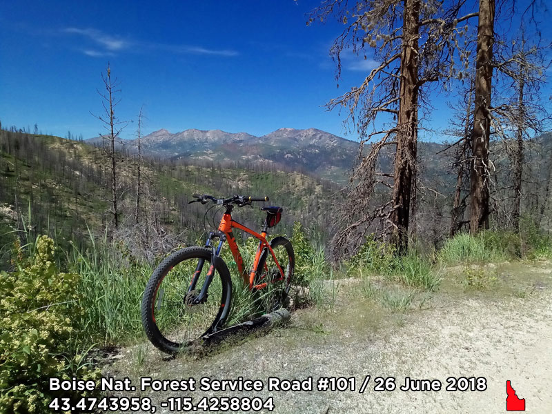
(March 23, 2019 / Author: Tim Bondy) This mountain bike ride on the tame dirt roads/doubletracks of Idaho’s Boise National Forest was spectacular. The Forest Service Roads (FSR) I rode are located north of the Fall Creek resort on Anderson Ranch Reservoir and in the general vicinity of the Ice Springs campground. While there is little in the way of technical challenges along the route, the vertical climb might kick your ass.
Featured Image Info: 43.4743958, -115.4258804 / https://photos.app.goo.gl/vxiLMydmvS89gXnr6
About the Fall Creek Area Ride
On Tuesday, June 26, 2018, I took my first mountain bike trip of the season into the green and verdant parts of the Boise National Forest. There are some fire roads that really don’t see much traffic and some that will truly test some people’s physical stamina on a bicycle in this part of southwestern Idaho, USA.
This was a 13-mile ride but clocked in at over 2,880 vertical feet and took me to places I’ve never been before and some places that have already tested me before. In any case, the ride certainly rekindled my desire to ride through the many tree-lined doubletracks of this area. It was also time to leave the summertime heat and dust of our local Idaho deserts and foothills until cooler weather returns later in the year.
“It’s time to expand my mountain bike range and locations.” ~ Tim Bondy
During the last 13 months, I have explored a small sample of the trails and roads of the Boise National Forest. There are good points and not so good points about mountain biking in this area. If you are looking for an uncrowded place to ride, there are many doubletracks north of Fall Creek that will provide beauty and solitude.
The Ride Stats
- Adventure Date: 26 June 2018
- Consider Doing it Again?: Yes
- Trailhead: 43.489013
- Turn-Around Point or Furthest Out Point: 43.223318, -115.549034
- Trail/Road #: FSR #101, FSR #137, FSR #128 and FSR #129
- Land Ownership: 100% Forest Service lands, I think
- Mileage: 13 miles
- +Vertical Feet: 2,886 feet
- Avg Slope from Google Earth Vertical Profile of the GPX File: 5.3%
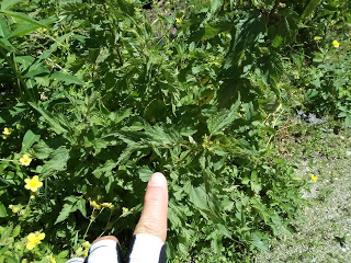
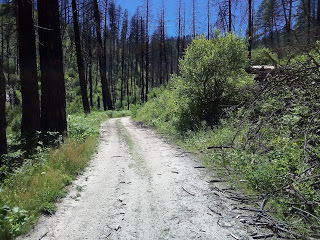
- Health of Local Environment – [Excellent / Good / Fair / Bad / Horrible]: Fair for recent wildfire scars but the recovery in places was quite spectacular.
- KML/KMZ File: FALL CREEK- Ice Springs Area – Bike – Prairie-Pine Road #128 to Myrtle Creek Road #101 (local file only)
- GPX File Name: 20180626-122641.gpx (local file only)
- Google Map Link on the Route: https://photos.app.goo.gl/5mFmtPePv6oKypXs7
- Driving Time to Trailhead: 75 minutes
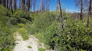
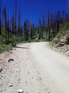
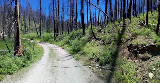
Some Photographs
.
.
.
After this ride, I headed down to Anderson Ranch Reservoir for an after-action swim. Refreshing, and swimming trunks will forever be packed in my bag for just such occasions. This ride would make a good adventure for locals and even people just visiting the tiny towns Mountain Home or Glenns Ferry area.
Originally published on this website on March 23, 2019, but was first published on July 4, 2018, at https://timbondy.blogspot.com/
Thanks,
~ signed ~
Tim Bondy
Freelance Writer & Citizen Journalist
“The idea of wilderness needs no defense, it only needs defenders.” ~ Edward Abbey