
(March 29, 2019 / Author: Tim Bondy) This 12 Oct 2018 Bennett Creek Trail ride is the third post from that trail and the fourth time I’ve ridden it. Because it’s close to my tiny, little town of Mountain Home, Idaho, I return to this area over and over again. It’s aerobically challenging, crowd-free and grueling good time.
Featured Image Info: 43.1898727, -115.4546585 / https://photos.app.goo.gl/2iT4ZCPZvHvWr42r9
About the Bennett Creek Trail Ride Adventure
It also pushes my average “steepness limits” for a ride at a 5.5% slope. The Thorn Creek drainage is about as far as I’ve ridden during my four attempts.
The ride can be expanded beyond my capabilities … Maybe as far as a 10-12 mile one-way ride by continuing past the Thorn Creek crossing.
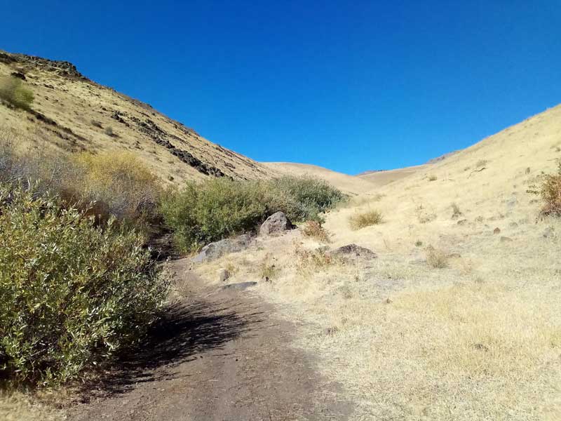
Pro’s: Close to home and it’s a challenge. Very little traffic. The rugged scenery.
Con’s: It’s steep and a real grind. Cheatgrass the entire ride.
“My goal is to make it well past the Thorn Creek river crossing before turning around.” ~ Tim Bondy on March 29, 2019
Bennett Creek Trail Ride & Trip Report Basic/Stats
- Adventure Date: October 12, 2018
- Consider Doing it Again?: Yes … this is a Favorite
- Trailhead: 43.124933, -115.450254
- Turn-Around Point or Furthest Out Point: 43.194798, -115.457072
- 7.5 Topo Maps: “Bennett Mountain” and a sliver of “Hot Springs Creek Reservoir”
Singletrack or Doubletrack: Doubletrack - Trail/Road #: The trail is included on the Idaho Parks and recreation map as a BLM Automobile road.
- Land Ownership: State of Idaho and BLM lands
- Mileage: 11.7 miles
- +Vertical Feet: 1,775 feet
- Avg Slope from Google Earth Vertical Profile of the GPX File: 5.5%
- Google Photo Album Link: https://photos.app.goo.gl/gN65Ffu98JnytgYUA
- Google Earth KMZ: BENNETT – Bike – Bennett Creek from Hot Creek.kml (local file only)
- GPX File Name: 20181012-130742.gpx (local file only)
- Driving Time to Trailhead: 25 minutes to a safe place to park
Uncrowded Terrain
Related Posts:
- http://bondyweb.com/2019/02/17/bike-ride-on-bennett-creek-trail-near-hot-creek-road-4-sept-2018/ published on Feb. 17, 2019.
- http://bondyweb.com/2019/03/15/mount-bennett-creek-trail-ride-in-idaho/ posted on March 15, 2019.
This article was posted on this website on March 28, 2019, but originally published on December 20, 2018, at https://timbondy.blogspot.com/
Thanks,
~ signed ~
Tim Bondy
Freelance Writer & Citizen Journalist
I am a proud citizen journalist, aka “enemy of the American People!”