(March 17, 2019 / Author: Tim Bondy) If you’re looking for a three to four hour adventure in southwestern Idaho, consider this easy-to-get-to hike in the Bennett Hills. The Rattlesnake Creek trailhead is located about 10 miles north of the Interstate 84, Exit 95, off Highway 20. The cross county hiking possibilities are almost unlimited if you’re willing to just wander or you could pick a peak and start walking.
Link to featured image at 43.21072, -115.53803 is https://photos.app.goo.gl/MX3zthyPznbg7GzC9
The Start
The beginning of the hike follows a short, yet unofficial, trail along Rattlesnake Creek canyon. The trail peters out about one-half mile upstream from the trailhead. My research indicates there is no private property in this canyon or on hillsides east/south of the creek. In addition, I saw no fences or signs indicating the lands I hiked on were anything other than federal lands.
At some point, you’ll have to go cross-country and head uphill east of the creek. Study a map to determine the best route or just wing it. Over-planning can be a killjoy when the goal is just to get away from it all for a few hours. Your choice, but I tend to like to plan my little adventures just to be safe.
Getting Uphill Fast
I started the cross-country portion of my hike at 43.209527°, -115.551625° and headed up the saddle to the northeast. Once on top of that saddle, I knew I would be heading up one of the draws to the north toward the high country. My only concern was I would hike up one of these steep gulches and encounter a sheer cliff of lava rock. That wouldn’t be the end of the world, but I prefer not to backtrack if I can avoid it.
Hiking from a saddle to the next peak, with only a semi-good idea of the route I planned, worked out nicely. In places, my one-boot-in-front-of-the-other path was quite steep but eventually leveled out with each saddle I got to.
I’m a firm believer in the stop and admire the view hiking plan. Do it often and you’ll see sights that will make the memory of the adventure much better.
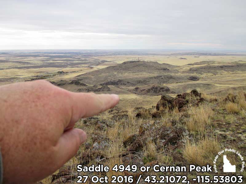
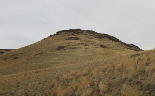
The Top and Bottom
My plan from the beginning was to make it to Peak 5,110 and to be honest, I thought the peak I was standing on at the top was that peak. Alas, I was wrong while standing on a saddle that topped out at 4,949 feet. Peak 5,110 and the more prominent Peak 5,268 were just one-fifth and one-half miles further east. Maybe next time.
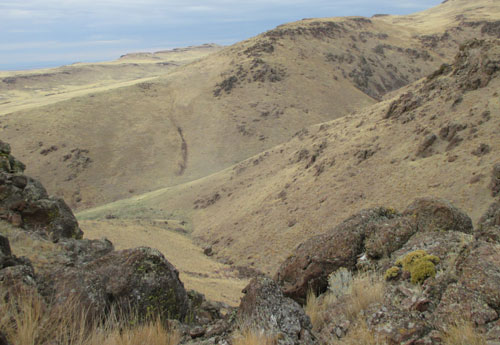
The route down, as the route up was, became a pick-and-choose track. The still green ribbon of Rattlesnake Creek below was plainly visible most of the way down, as was Highway 20. That meant I could explore a little. One of those little side trips, while beautiful, was cliff bound and meant a backtrack to a safer route.
Mushrooms?
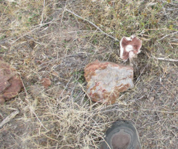
I’ve done my fair share of hiking in the Owyhees and the foothills around Mountain Home. Never have I encountered more than an oddly placed mushroom. However, on this hike, I walked past more than 20 white mushrooms on this <4 miles hike. My untrained eye and not-mushroom educated senses told me they were only about one week past their prime. Are mushrooms unusual at this time of the year? To me, for sure.
The Stats, Links and Directions
- Hike: 3.44 miles
- Trailhead: 43.206179, -115.555388
- Elevation Gain/Loss: 1,242 feet
- Average Slope: 10.4% and -14.2%
- Big game animals seen: none
- Link to photo album from the hike: https://goo.gl/photos/UqxRBHwuYF8y7M7o8
- Directions: from the intersection of Highway 20 and Interstate 84, Exit 95, drive north/east on Highway 20 for eight miles. The unmarked turn-off is on the right or east side of the roadway.
- Cernan?: This moon-scaped hike had to be named after the last human who stepped off the moon – Eugene Andrew “Gene” Cernan
- Political Post-It Note link: https://docs.google.com/presentation/d/1So1Cob_i1XLiNM8qf8rwyenRmV0zkjumAsT5CCy5utI/edit?usp=sharing
This post was last updated on 17 March 2019 but originally published on http://bondyblogs.com on 31 Oct 2016.
Thanks,
~ signed ~
Tim Bondy
Freelance Writer & Citizen Journalist
Ending Pun: A lot of trees were dying, but they needed to figure out the root of the problem.