(February 6, 2019, / Author: Tim Bondy) Lime Creek is a fun hike in fishing trip in the Sawtooth National Forest. There are two ways to get into this particular section of the creek … The cross-country hike or the designated trail called Slickear or FSR #193. If doing a cross-country hike, be careful heading into the river canyon as treacherous scree slopes exist in many places. I have discovered a simple straightforward route down.
Link to Featured Photo: https://photos.app.goo.gl/jfnJG3jnQarvfZUZ9
This hike-in fishing trip was the fourth adventure since I hurt my back on July 9, 2018.
Introduction to the Adventure
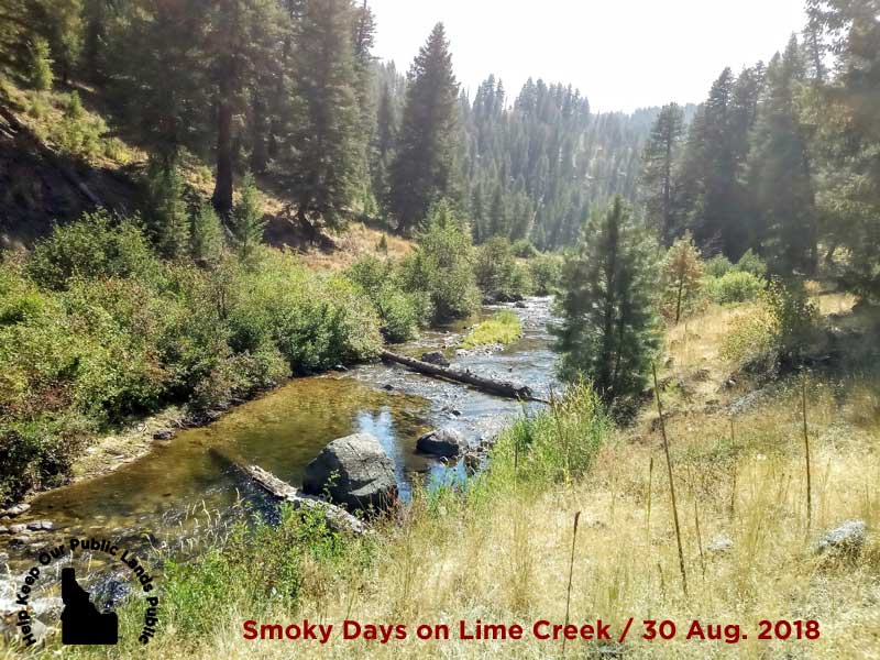
This was a fun hike-in fishing trip down to Lime Creek. Fishing this portion of the creek is only possible during low-water or late season. The cool part is that there is an unofficial and little-used trail leading all the way down to the creek and the fishing should always be outstanding. There is an official trailhead called Slickear motorcycle trail / FSR #192 heading down the canyon about 4/5 of a mile further along FSR 181A.
“The cool part is that there is an unofficial and little-used trail leading all the way down to the creek …”
Hike-in Fishing Trip of Lime Creek – 30 Aug 2018
- Adventure Date: August 30, 2018
- Trailhead: 43.406058, -115.192572 although FSR #181A can and does get extremely rutted, so expect to park 1/2 mile further south.
- Turn-Around Point or Furthest Out Point: 43.421629, -115.191004
- 7.5 Topo Maps: Sprout Mountain
- Land Ownership: 100% U.S. Forest Service managed lands
- Mileage: 3.46 miles
- +Vertical Feet: 1,300 feet
- Avg Slope from Google Earth Vertical Profile of the GPX File: 11.4%
- Google Photo Album Link: https://photos.app.goo.gl/yJaCm9W2GMgsnARr6
- Name of KMZ File in Google Earth: ANDER-Hike-Fish Lime Creek.kmz (local file)
- Archived GPX File: 20180830-124647.gpx (local file)
Summary of Adventure: This “late season only” hike-in fishing trip will likely be an annual event for me. There are a ton of rainbow trout in this little-fished portion of Lime Creek and it’s beautiful.
It’s about a 40 minute hike from the trailhead to the creek but the hike out will be closer to 70 minutes as it’s a substantial uphill grade. The scenery is also quite nice as it transitions from the typical wide open and treeless environment to a tree-lined trail for most of the way down to Lime Creek.
“There are a ton of rainbow trout in this little fished portion of Lime Creek and it’s beautiful.” ~ Tim Bondy
Expect to share this river canyon with cattle. While I’ve never seen a cow down there, the signs are everywhere 💩 😯 💩 There are short, intermittent trails following the creek in places and it might be worth looking for them instead of walking in-stream.
On this particular hike/fish, I headed upstream or east. The next time I might want to head downstream. However, I had better luck catching bigger fish and more consistently casting upstream.
Map of Lime Creek Area
Grid code: CRC4+CH Pine, Idaho
Lime Creek: 43.4210472, -115.1935883
Originally published elsewhere on September 18, 2018
Sincerely,
~ signed ~
Tim Bondy – Freelance Writer
“For the Benefit and Enjoyment of the People.” ~ Theodore Roosevelt in 1903