
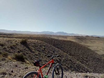
(January 31, 2019 / Author: Tim Bondy) This dusty doubletrack heading south into the Owyhee Front near Oreana, Idaho is a fun and unique ride. The scenery is incredible in places, there are opportunities to rockhound and maybe even catch a glimpse of a bighorn sheep. I will be out on these trails again in 2019 and into the future.
Link to Featured Image: https://photos.app.goo.gl/JgqwkE8tKXps2UNY6
Coordinates: 42.9024849, -116.470665
Introduction to the “Spivey Road to Alder Creek Ride”
This is the third time I have ridden this area and forth or fifth time I’ve been down there when including ATV trips. The scenery is very nice and unique, plus the sheer length of possible rides make this a great adventure. As of this trip, I still haven’t made it to the end of the road. The end of the road is where it hits a small portion of private property.
Pros: Scenery, obsidian, fossils, and solitude. No driving on dirt/gravel roads.
Cons: Dusty and it’s a rough and washboarded doubletrack road while not being technical at all. Cows and cow poop.
Spivey Road to Alder Creek Ride Trip Report Basic/Stats
- Adventure Date: Sept. 16, 2018
- Consider Doing it Again?: Yes
- Trailhead: 43.024630, -116.391202
- Turn-Around Point or Furthest Out Point: 42.902463, -116.470772
- Road/Trail Name and/or Numbers: Trailhead begins on BLM Road C701 and transitions to something called Road 3795 or “MILTS-Ch.”
- 7.5 Topo Maps: Oreana and Antelope Springs
- Land Ownership: Most of the land is managed by the BLM but there are a few parcels of Idaho State lands. Watch out for private property in the creekbeds and at the 12-mile point on Alder Creek Road.
- Mileage: 21.7 miles
- +Vertical Feet: 1,577 Feet
- Avg Slope from Google Earth Vertical Profile of the GPX File: 2.5%
- Google Photo Album Link: https://photos.app.goo.gl/pMbdcE1rYWavT3bL9
- Google Earth KMZ: OWY – Bike – Spivey Rd to Alder Creek Oreana area.kmz (local file)
- GPX File Name: 20180916-122930.gpx (local file)
- Driving Time to Trailhead: 1 hour
Summary of Ride: This was a straightforward ride in the Owyhee Front heading south toward Toy Mountain. It’s not an overly strenuous ride but the sheer length makes is much more difficult.
“No one rides in this portion of the Owyhee Front” ~ Tim Bondy
Gathering obsidian in large quantities on this ride would be quite easy and some fossil hunting is also possible. This is hard rock mining territory with gold and silver discoveries likely but only deep underground.
There are a few alternate doubletracks available in this area and they should be explored in future adventures.
Link to Map of the Area: [ WHFC+2V Spiry Place, Idaho ]
https://goo.gl/maps/4H2W5NxgXFJ2
Originally published elsewhere on October 2, 2018
Sincerely,
~ signed ~
Tim Bondy – Freelance Writer