Note: This post was migrated to this website in 2019. It was updated at that time and was again updated on 21 Sept 2020.
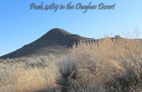
(February 2, 2012) This rockhounding trip was a long time coming. I’ve been eying this small but completely cool looking peak along the Owyhee Front for over 3 years. With obvious “volcano” looking characteristics, I was hoping to find some cool rocks. The hike was wonderful with brilliant blue skies and the usual solitude of the high desert.
The Hike
One of the problems in this area is finding a parking spot off Poison Creek Cut-off Road. Yeah, you can pull off the shoulder of this gravel road but one never knows how soft and gooey the shoulder will be until you get down there. So I decided to play it safe and park on the side of a double-track trail heading almost straight towards Peak 4189.
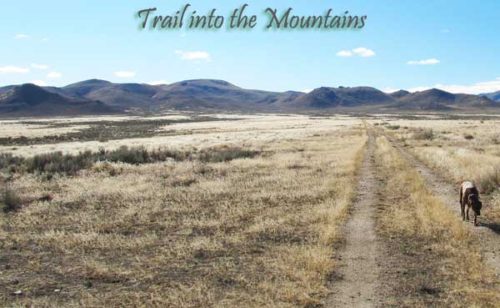
My dog Addie and I headed south on foot along that double-track trail. Pretty simple walk that gradually climbs the further south you go. Once this trail ended, we headed off-trail straight towards the easily identifiable Peak 4189. Again, the grade is rather slight as it approaches the base of the peak.
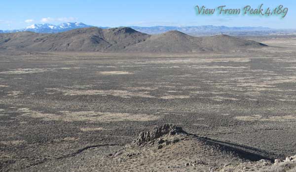
Once at the base of Peak 4189, the climb gets steep and rocky. But it wasn’t long before we summited out. The sweeping views from the summit are incredible even though the peak only rises about 500 feet above the plains where we parked. As usual, the winds on these Owyhee peaks were quite a bit stronger than down below.
The hike back to the car was mostly off-trail along 3 different dry washes. We explored a few man-made objects out there and followed a few game trails. Yep, there are still deer, antelopes and coyotes alive and roaming the Owyhee Front. Plenty of tracks and scat to prove it.
Hunting Some Cool Rocks
The rock hounding was a little disappointing on and around Peak 4189. There is an abundance of bright white quartz and some near clear chunks up there. But nothing I saw made me want to bring a specimen home with me.

Obviously someone found something of interest on the flanks of Peak 4189 as there is a mining claim marker up there. Because the claim marker was just lying on the ground, I suspect the claim is abandoned. I’m reasonably sure if I had made a real effort, I would have found some cool rocks but this was just an exploratory trip. In other words, there wasn’t any “low hanging fruit” just lying on the ground. I’ll be back for some serious rock hounding later in the winter or early spring.
Peak 4189 Hiking Statistics
Total Distance of Hike: 3.56 human miles. About 20 Addie Dog miles
Elevation Gain/Loss: 553 feet
Average Slope of Entire Hike: 6%
Average Slope from Base to Peak: 20.1% in about 1/5 of a mile
The Land
The entire hike was done on public lands with a majority-owned by the State of Idaho. BLM lands, as usual in the Owyhee’s, made up the ownership of the rest of the hike.

This is ranching land and the entire hike was done on the East Castle Creek Rangeland Allotment. Expect cow patties along any route you take from the car door to the summit of Peak 4189. The predominant vegetation was, unfortunately, “cheatgrass” with areas of sagebrush.
The Rough Mountain Quad Topo Map shows this peak has an elevation of 4189, while my GPS unit showed the (un)-true elevation at 4,140. I seriously don’t know if my GPS unit is off by almost 50 feet or the 1992 Topo Map is wrong.
Thanks for visiting the Bondyweb,