
The Hike
Parking at the 5,325 foot level (43.184111, -115.324555) my dog Addie and I headed uphill on Bennett Mountain Road. Starting off, this gravel road was rather soft and wet after the recent rains. I tried a few off road attempts to get a look into Little Canyon Creek. But mud just caked my boots so I never made it more than a half dozen steps off the road before turning back.

I tried a dirt road down to the creek and found it passable for the most part but there were spots where I sunk deeply into the mud and muck. But at least I got a close-up view of Little Canyon Creek and Addie got a drink.
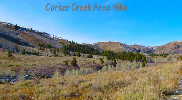
The higher we hiked on Bennett Mountain Road, the more spectacular the views became. To the north and west was the hoodoo filled Corker Creek canyon. The view up Burns Gulch gave me hopes of hiking that valley when conditions are a little better. And the butte like structure on the south end of Peak 6350 was fascinating to say the least.

At around the 5,660 foot mark, ice started to become the main walking surface on Bennett Mountain Road. And by the 5,690 mark the road was completely ice covered and walking became a lot more difficult for me. However, Addie seemed to enjoy the situation and did a lot of ice skating just for the fun of it. I’ve never seen a dog run and slide on ice just for fun but that’s what this crazy dog did.
 |
| From BondyWeb Idaho Photo |
We turned around after about 1 hour of walking at the 5,790 foot mark (43.205278, -115.341059) just after a truck passed by on their way down the hill. I know this couple was white knuckling it down the sheet of ice and was glad I was the walking. Amazing enough during almost the entire hike we had a grand view of the Snake River Plains and mountains of Nevada.
Why I Liked This Hike
The Corker Creek area Hike on Bennett Mountain Road was an eye opening experience. I’ve never been this far up the road and I see many future hiking opportunities in this area. I’ll just have to wait until it dries out or becomes snow covered.
The scenery on this portion of the Bennett Mountain area is wonderful. I’d really like to head up the Corker Creek drainage but I’m pretty sure the entire Corker area is private property. But Burns Gulch looks to be BLM land for the most part. I’ll likely head back up to this area again real soon.
Map of Hike – Blue line is actual GPS Track
View Larger Map
Hiking Stats
Total Mileage of Hike: 4.0 miles
Elevation Gain/Loss: about 600 feet
Highest Elevation: 5,974 feet
Average Slope Along Hike: 5.1%
Miles from Mountain Home: 48 miles
You can contact me about this hike using my Contact Us form or leave a comment below.
Thanks,
