
The Importance of Plan B
(16 November 2011) Today’s hike was on Bennett Mountain Road north of Glenns Ferry, Idaho. While not my first choice, it’s a great place for a short hike but also severely stretches my Two Hours Door-to-Door criteria. Sometimes you gotta break the rules in order to explore.
Bennett Mountain Road climbs, amazing enough, into the Bennett Hills from the south. Drive far enough on this road and you’ll end up on Highway 20. But staying closer to Mountain Home means you can stay entirely on paved roads to explore. And this is what we did. Parking just below where the road summits the Bennett Hills, we hiked up this mostly traffic less road and then detoured east off into the sagebrush towards the canyon on Little Canyon Creek.
 |
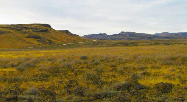
| From BondyWeb Idaho Photo |
The views of the Snake River Plains from the hikers’ vantage point are wonderful. The Jarbidge Mountains of Nevada were visible as well as the Silver City Mountains and the Blair Trail Reservoir. Once we headed off road, the going got a little ankle-twisting but it was well worth getting of paved surfaces.
This area is volcanic and hiking the prairies off Bennett Mountain Road means navigating around an abundance of baseball to watermelon sized rocks and sagebrush. In order to stay at least close to my 2 hour total time limit, Addie my dog and I did not get to the Little Canyon Creek rim. But it was a nice hike none the less.
Map of Some Features Mentioned in this Article
View Larger Map
Plan A was a Nuclear Devastation Looking Mess
Originally, I had planned to hike what looked like a narrow dirt road east of what I called Emigrant Reservoir (Trail Diversion Dam). But as luck would have it, a fire ravaged the sagebrush steepe in this area early this year. I did not know this when planning the short hike.
 |
| From BondyWeb Idaho Photo |
The fire zone in this area starts at the south and east end of Emigrant Reservoir and extends more than 2 miles to the north. While I could have stilled hiked out to my original destination, it would have been rather ugly and somewhat depressing.
Red and White Flags – What does it all mean?
Shortly after getting on Bennett Mountain Road, I found red and white flags marking the roadside. I’ve never seen this before and don’t know the significance of these flags. Maybe you do.
 |
| From BondyWeb Idaho Photo |
My best guess is some kind of visual aid for fence builders to string barbed wire?
Huge Pipes
Out on Bennett Road, near some windmills, I spotted some huge pipes. These pipes were also spotted elsewhere in this same general location. My guess is the pipes have to be 7-9 feet tall and about 15 feet in length.
 |
| From BondyWeb Idaho Photo |
I have no idea what the function of these pipes is. I cannot imagine they carry water so maybe conduit for the windmills?
Links
– Part 1 of Short Hikes Close to Mountain Home Idaho.
– Part 2 of Short Hikes Close to Mountain Home Idaho.
Enjoy,
