Terrible Maps – Motorized Traffic Closure Ordered by BLM from the Hot Tea Fire

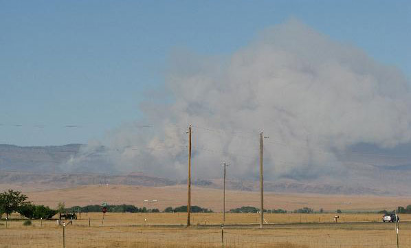
The end of August 2010 saw a 5,500 acre fire erupt north of Mountain Home Idaho. The Hot Tea Fire was fought by at least 5 air tankers and ground crews from a number of State and Federal agencies. The general area that burned is located about 10-15 miles northeast of Mountain Home Idaho on the south flanks of Bennett Mountain.
Your Prison Term and Fines…But?
On January 27th, 2011 the Bureau of Land Management (BLM) issued a motorized vehicle closure notice in the burn area. This is a 2 years closure order, so starting in 2013, those of us who access the backcountry with ATV’s have a long time to wait before getting into this area again. While I completely understand AND SUPPORT the decision of closing this area to motorized vehicle including ATV’s and UTV’s, our government needs to support “the people” too.
From the news release:
“Anyone violating the closure may be tried before a United States Magistrate and fined up to $1,000, imprisoned for up to 12 months, or both. Violators may also be subjected to additional fines.”

$1,000 Fine and 12 Months in Jail Question – Where?
The BLM created and posted a map of the closure area on their website. This wonderfully colored map has all the lines and shading to wow the public. But the public doesn’t need “shock and wow” maps. We need precise and accurate maps. If the government wants to throw me in jail and fine me for violating the closure order, then it should be up to that same government give me all the tools and information needed to comply with these regulation.
Information is What We Need
My complaint is out in the open. The solution is quite simple, cost effective and the best possible option for “the people”, the government and the environment.
- Google Earth Overlay: Create a map overlay file (kmz/klm) that can be opened on the free program called Goggle Earth. “The People” just need to download this small file the BLM can easily create, double-click said file and the closure area is magically displayed in a scalable and zoom-able presentation.
- Free Topo Maps: Create the map on electronic USGS Topo Map. These types of topo maps are offered by our government for download and are completely free. The BLM should be required to overlay the “closure area” on these maps and offer them for download on their website.
- Signs: The BLM Closure Notice stated signs and fences will be placed in key access locations. This is great…But doesn’t help me when I am deciding where I will be riding my ATV a week or a day prior to heading into the hills/mountains.

The Short Story for Success
The BLM can provide “the people”, the public, us dudes the tools and information we need to protect the environment and to comply with the law. The map currently available on the BLM website wasn’t just magically created in PDF format. They used GIS software to create certain files and converted those files into what you see on their website. These same GIS software files will also convert quite easily into Google Earth files and USGS topo map overlays. Our government needs to promote, educate and more importantly, utilize this technology.
Help Wanted – Comments
I’d like to hear what you have to say about this article. Hate ATV’s? Let me know how you feel. Want info on mapping and the FREE tools I use to plan hiking, ATV or rock hounding adventures? Leave a comment. Or just leave a comment so I know you exist.
