Idaho Topo Maps for Rock Hounds, Hunters, Hikers and ATV Folks – They Are Free

The United States Geological Survey is in the process of creating new topographical maps for Idaho…and the most of the US. These new generation maps now include satellite imagery along with the usual elevation contours. This might or might not be a great thing for outdoor enthusiasts such as hikers, rock hounds, ATV’er and hunters.
My Review of the New Topo Maps
I’m a little disappointed with the new generation maps for the following reasons:
- They have eliminated some (a lot) place names from the maps
- Old mine sites are not included and this might be a concern for rock hounds.
- Elevation contours numbers are not marked as frequently as the old maps and peaks do not have their elevation indicated.
- Currently available for only southern Idaho.
What I like about the new generation Topo Maps
- The visual display is easier to read. They are digital and much cleaner than the old maps.
- The satellite data overlay helps visually fill in data such as unmarked roads and trails.
- They are free to download but so are the old topo maps.
- Currently available for for most of the Owyhee Mountains and Desert.
How to Download Topo Maps
1. Go to the USGS Map Locator website at:
http://store.usgs.gov/b2c_usgs/usgs/maplocator/(xcm=r3standardpitrex_prd&layout=6_1_61_48&uiarea=2&ctype=areaDetails&carea=%24ROOT)/.do
2. Zoom in to the general location you would like to explore and get maps.

3. Click the orange button and take note where the “red hashed” areas are.
4. Zoom in even closer to find the exact location you want maps.
5. Click the “MARK POINTS” radial button on the right side of the page.
6. Click on the map to drop a marker. Click the marker and download the map to your computer.
7. Open the map in your favorite PDF program.
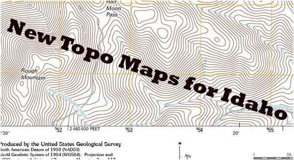
Visual Comparison of Maps
Old Topo Map of Little Half Moon Pass in the Owyhee Mountains
New Topo Map of Little Half Moon Pass with Satellite Imagery
New Topo Map of Little Half Moon Pass without Satellite Imagery
From what I can gather, these new topo maps will be updated about every 3 years. It sounds like they will also be including more place names as the technology matures.
What Are Your Thoughts
So…what do you think of these new maps? I’d like to hear what your experience is. Would you rather use the old version or the new version. Leave a comment and/or pass this article on to others who may not know about the USGS Store and the free maps they provide.
Tim Bondy
The Bondyweb.Com author