 |
The Forest Service announced the Danskin Mountains off-road riding area was opening up on Saturday April 24th, 2010. This was good news for me as I had a long planned hike in this area and wanted to try something new. This hike was supposed to be focused on a geologic feature along a ridge-line south of the Danskin Lookout.
This geologic anomaly was along an earthquake fault and a supposed unusual rock intrusion in the usual Idaho lava landscape. My thinking was there would be some cool rocks and hopefully something worth bring home. The catch was the hike into and up the ridge-line would be a long and rough hike in from the Danskin Lookout Road. I was a little, if not a lot skeptical I would find anything interesting considering that I saw nothing special on Google Earth. So when I heard the Danskin Lookout Road was open for ATV’s I decided to take the easy way out and ride into the area. I loaded my ATV into the truck and headed up Canyon Creek Road.
The weather up there was cool and blustery but the skies were generally blue with some high clouds streaming in from the west. I expected to see a line of trucks heading up into the Danskin Mountains but was pleasantly surprised I saw very few people heading up into the hills. My route of travel would take me down a road east of the lookout road while following Crown Creek for part of the way. Once I made my way through the water bound portion of the road going through Crown Creek, my plan was to head towards Syrup Creek. Then I’d head back towards Crown Creek,and find a draw to hike up towards my geologic goal on the ridge-line to the north.
 |
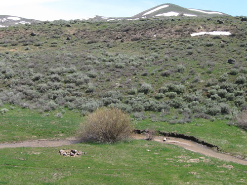
Crown Creek
Before I got to Syrup Creel though, I found a dirt road heading almost straight north and straight into the mountains. I ATV’ed almost to the end of this unknown road, high on the ridge-line where there was some fantastic views of Bennett Mountain and the Snake River Valley with the Owyhee Mountain seen in the hazy distance. I did find the rock intrusion zone I was looking for on this ridge. And as I had feared, it was just some "tanish-gray-white" granite that is so common in the Owyhee’s. Just outside this zone I did find some "crystaly-not-quite obsidian" that reminded me more of asphalt. So basically the small area I explored was basically sterile of any rocks I could even remotely say were "cool and collectible".
I found the area I rode in to be pretty cool with some good scenery. The road was still wet in spots as expected this soon after snow melt time. It was also quite rough…not rough enough that a 4-wheel truck would have problems but the going would be very slow. I never got my ATV much about 15mph while out in the wild portions of the trip. Of note, there were a few marked places along the road indicating the Jeffrey-Goodale Cutoff on the Oregon Trail went through this area. This area also seemed to be a place not many people visit except ranchers and hunters. If the size of the deer/elk poop is any indication of the size of the animals that roam these mountains, I’d say some BIG ungulates call this home.
More Pictures:
Here is a link to more pictures.
http://picasaweb.google.com/tim.bondy/DanskinMountainsSyrupCreekAreaATV?feat=directlink
Google Map:
Here is a link to a map of my complete ATV trip. The route is highlighted in a "Light Blue" color that might be initially hard to see:
http://maps.google.com/maps?f=q&source=s_q&hl=en&geocode=&q=http:%2F%2Fbondyweb.com%2Fkmz%2Fsyrupcreek1.kml&sll=37.0625,-95.677068&sspn=53.432436,135.263672&ie=UTF8&ll=43.391779,-115.706741&spn=0.3872,1.056747&t=p&z=11
Thanks for visiting and commenting on this story.
Tim Bondy
The Bondyweb.Com author