Monday March 22nd, 2010 Local Hike Just North of Mountain Home
 |
The warming Spring weather had me thinking about hiking the mountains north of Interstate 84 so I started looking around for an easy to get to hike on public lands. After a long study of the area on Google Earth, I found a peak just north of Immigrant Road (a.k.a Tollgate Road) west of Highway 20. There is a nice parcel of public land in this area so off I went.
About the Hike
The beginning of the hike was a little annoying as I did my homework and determined that all the land I would be on during the hike would be all PUBLIC land. But within a few minutes I encountered a fence that seemed to indicate the land was private as it had worn reddish paint on the posts. Or was that rust? In any case, I found a place to squeeze through the barbed wire strands and headed up the ridge towards my goal.
 |
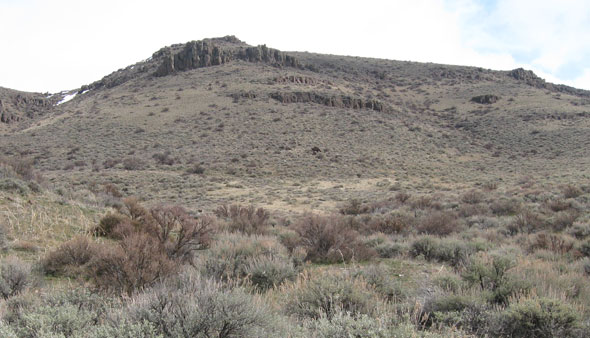
My track took me up a dry wash that got steeper and steeper as I went higher. The scenery going up was quite nice with old lava outcroppings and the occasional snow drift higher up the wash. The wash highlighted my path and being early in the Spring, vegetation wasn’t much of problem. I wouldn’t want to head up this wash in the late spring as prickers and various other plants will likely make this hike much less enjoyable.
There is a ridgeline on the north side of the peak and once I got up to that point the way to the top was snow covered, windy and exposed to all the weather elements. As I headed up towards the peak a strong snowshower moved in, the wind kicked up and visibility dropped to almost nothing in snow and fog. I was in a winter wonderland at this point that just added to the enjoyment of the hike. But as suddenly as the weather closed in on me, the clouds moved on, skies cleared and the wind died down. The views from the peak were amazing and I found a nice rock alcove on the south side of the mountain where I could rest my weary bones in relative comfort, while overlooking the Snake River Valley.
 |
The hike turned out to be a little more strenuous than I expected. It turned out to be quite a challenge for this 50 year old guy that is out of shape but still willing to explore new places. Much to my surprise, the mountain top was quite clean with the only trash seen was a few shotgun shells. This area also being a cattle grazing allotment surprisingly lacked large amounts of cow patties. As a matter of fact, the entire hike showed signs of heavy use by deer and antelope in the no so distant past.
Want to see the track I took for this hike overlayed on a topo map?
 |
Click picture to download or view this map. My track is highlighted in red at the bottom of this PDF style map.
Rock Hounding Possibility?
This hike was quite sterile of any cool rocks unless you are into rhyolite. In that case, there is tons of the stuff in colors ranging from brown to chocolate brown to lime colored lichen covered specimens. There are better rock hounding opportunities elsewhere.
See more pictures from this hike at: http://picasaweb.google.com/tim.bondy/Peak5270?feat=directlink
Thanks for visiting and commenting on this story.
Tim Bondy
The Bondyweb.Com author