Last updated: 26 December 2020 to fix a link to more photos.
On Saturday, July 11th, 2009 I headed out of Mountain Home, Idaho on Highway 20. My destination was Boardman Peak in the Pioneer Mountains north of Hill City. Armed with my GPS unit, camera, and directions to get to the trailhead, I pulled off Highway 20 and made my way into the foothills. Of course, I got turned around and made a few wrong turns while looking for the trailhead. But once I found the parking area, I easily found the trail headed towards Boardman Peak.
I did a lot of map research for this trip and nowhere does it indicate that Sheep Trail is a continuous trail headed into these mountains. The good news, sheep trail is quite easy to find and follow, meaning cross country hiking isn’t necessary. Because the sheep trail was such an easy to follow but also steep and rugged trail, I decided I would hike where ever the trail lead me. The trail goes straight to Boardman Pass and not Boardman Peak.
 |
Sheep Trail / a.k.a. The Boardman Pass Trail
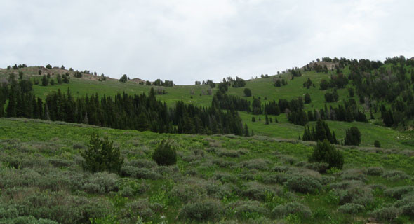
Sheep Trail is a well-established hiking and motorcycling trail that starts at about 6,600 feet and heads straight north towards Boardman Pass at about 8,440 feet. In short, this trail is rather steep in many places and can be difficult for those not in good shape (Me, for example). I expected a wide-open hike with few trees, as that is how it looks on Google Earth. In reality, the route is quite scenic with much flora and fauna to keep the hiker occupied. Once you get into the higher elevations, the vista’s really open up and “you can see for miles and miles”.
There are a few water crossings on Sheep Trail. Only one was of any concern on this July 2009 trip and that creek crossing was Lime Creek. It was a pretty easy step stone across where my feet hardly got wet. The other creeks are very small and one can easily step over or around the watercourse.
The bad part about this trail is its overall condition. Some pretty long and steep stretches are deeply rutted and erosion-prone. These deep ruts are only about 6-9 inches wide resulting in having to hike like you are walking on a balance beam. And did I mention it was steep in these parts?
 |
The Pass
Once you get to Boardman Pass the views are wonderful. The sweeping views to the north and south kept me occupied for quite a while. From this pass, cross country hikes towards Smoky Dome or Boardman Peak on this ridgeline could extend your hiking day. Even this late in the year, there was still a pretty substantial snowbank on the north side of the ridge to cool down on.
More Pictures
Link to picture more photos: https://www.google.com/maps/d/u/0/edit?mid=13NlJv14Mfa41y1r5ZGn0jztfaftX0YIV&usp=sharing
Driving Directions (Cut and paste from IdahoSummits.Com website but with a few corrections and additions)
From Highway 20, turn north (left if coming from Boise, right if coming from Fairfield) at virtual mile marker 144.2 on 800 W. Follow 800 W for 1.9 miles to 200 N. Turn left/west. Follow 200 N for 2.7 miles and turn right onto 1100 W. Drive 1 mile and pass a large parking lot. Just past the parking lot, turn left onto the road signed “Chimney Creek/Ear Creek Corrals”. This road is dirt, but free of rock, so accessible by cars. Follow Forest Service Road 484 for about 8.5 miles to the Ear Creek Corrals. Just past the Ear Creek Corrals, the road banks left. At 9.5 miles you reach the trailhead, which consists a registration box (no longer empty) and a message board (with some things posted on it). The Sheep Trail is the right fork heading north, not the road continuing west.
This story was last updated on 26 December 2020.
Thanks,
~ signed ~
Tim Bondy
Freelance Writer & Citizen Journalist