 |
On Sunday. April 19th, 2009 my wife, dog and I headed down to the Owyhee’s for little easy hiking. We left Mountain Home around 11:30AM and headed south after filling up with gas. The temperature was around 58F with blue, blue skies.
Our general destination is what I call Birch Creek Road but might be better known as BLM Road 3724 or something else. For lack of a better name, this road will be known as Birch Creek unless someone has a better name. We headed through Grand View and drove west on the Grand View Highway for about 8 miles before turning south on a gravel road called "Missile Base Road". This road intersects the Poison Creek Cutoff at the foot of the Owyhee Mountain. From this intersection the road becomes quite rough but easily passable in my non-four-wheel drive truck.
 |
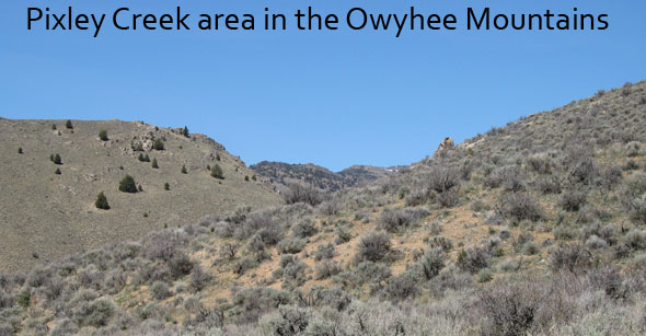
After about 6.5 miles and one closed gate, I expected to find a small turn off in the Pixley Basin that headed up a cool looking gulch. Using our GPS unit, we drove right passed the turn-off not ever seeing a spot big enough to park the truck in. At this point in the road, it is a very narrow bumpy dirt/sandy road so we couldn’t stop. We continued west on Birch Creek road looking for a parking spot and/or a turn-around. We eventually found a place to turn around but decided to stop, stretch our legs and explore first. We found some cool looking rocks that might have had embedded silver in them plus some poor examples of smoky quartz. While the scenery at the place we stopped was quite nice, we needed to find a proper place to park and explore.
We turned around headed back the way we came. We did a slow drive-by of what I’ll call Pixley Gulch but is really an unnamed draw. There just wasn’t any place to park near our gulch so we continued to head back east. We came upon a wide spot in the road that wasn’t exactly the most beautiful spot but did have a road headed up a hillside. We park and got out just before a couple of ATV’ers came by. The two young men stop to talk to us. In short, they told us they spotted many deer and antelope plus a mountain lion well off to the west and south. Those two guys took off and we headed up the hillside but my dog’s enlarged heart wasn’t into it. I stayed with the dog and my wife continued up and up and over the top of the hill for some rock hunting and scenery looking.
 |
While we didn’t get to hike the steep river gully we wanted, we still enjoyed our trip out to the Owyhee’s, the scenery and made plans to come back to these enjoyable but primitive "deserty" mountains.
 |
We only saw two other people but many more cows on this trip
Details
Date: 19 April 2009
Author: Tim Bondy – Photographer: Tim and Toni Bondy
Contributing Editor: Minnie Dog Bondy
Where: Along BLM Road 3724 or Birch Creek Road to the Pixley Basin in the Owyhee Mountains of Idaho
Mileage: From Mountain Home, Idaho about 56 miles
More Pictures
Web Address of the above Slideshow of our Owyhee Trip Report is:
http://picasaweb.google.com/tim.bondy/BirchCreekRoadOfTheOwyheeS?feat=directlink