Click photo
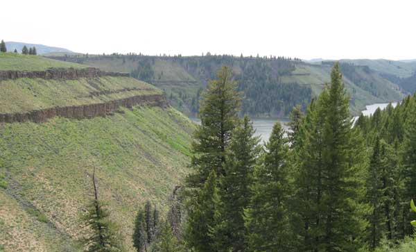
Wednesday May 25th, 2011: The Wilson Creek to Little Wilson Creek trail near the Anderson Ranch Dam was my destination. This local hike was one of my favorite hikes I’ve taken in a long time. Why? It’s only a 30 miles drive from Mountain Home, the scenery is great and it’s geologically fascinating. I’ll do this hike again.
Where is Wilson Creek?
View Larger Map
Trailhead Coordinates: 43.381256, -115.437006
The Hike
The Little Wilson Creek hike starts just off the Anderson Dam Road on the north side of the reservoir. The hike follows and crosses Wilson Creek for ¼ mile before heading up the Wilson Flats escarpment.
At the ¼ mile point, the trail gets steep and rocky as you head up to Wilson Flats. You can get some good views of Anderson Reservoir along this section as the trail is carved right out of the side of a mountain.
Once up on the “Flats” you’ll see a fork in the trail so you’ll want to head northwest on NFS Trail 607. This portion of the hike follows Little Wilson Creek and is quite scenic and peaceful. This river valley is quite lush with plenty of aspen and pine tree groves.
I hiked up this well maintained trail for about 1.25 miles before turning back but you should be able to extend the hike a little further if you want. I think it would be worthwhile as there would be some excellent crosscountry hiking opportunities up there.
Some Things About This Hike
1. I saw 2 mule deer on Little Wilson Creek. As my dog was with me, I’m glad she didn’t get sight nor smell of these creatures. My dog doesn’t like surprises and she would have coward behind me the rest of the hike.
2. I encountered my 1st snake of the year. I’m not a snake person but suspect it was a Western terrestrial garter snake. Just a heads up…snakes are out and about now.
3. Scat: Dog? Coyote? Wolf? Caveman? See picture above.
4. A Bald Eagle was seen perched in a tree below me and then I got to watch this magnificent bird soar the windy thermals for about 5 minutes before it headed over the next ridge.
5. My original plan was to hike up to Wilson Flats and head to the edge overlooking Anderson Dam. Well, I didn’t do this. Even with a leash on my dog, I figured one little slip of hand and I’d be picking up a blood splotch on the road home. Better safe than sorry.
6. From the trailhead and up onto Wilson Flats (NFS Trail 606) is designated for ATV and motorcycles. This is something to keep in mind when attempting the hike on a weekend.
Rockhounding Potential
I never would have thought the rhyolite cliffs in this area would give way to some very good rock hounding potential. The steep trail up to Wilson Flats is covered with interesting rocks. Smokey quartz, feldspar and even some tiny crystals were easily found even along the upper reaches of Little Wilson Creek.

Hike Stats
This hike was a breakthrough for me personally. It’s the first time I’ve hike more than 1,000 vertical feet in a few years. I’m getting in better shape…Yeah!
- Total Hike Length: 4.98 miles
- Total Elevation Gain/Loss: 1,225 Feet
- Max Slope: 40.7%
- Average Slope: 8.5%
- Beginning Elevation: 4220 Feet
- Highest Elevation: 5148 Feet on Little Wilson Creek Trail.
- Number of people encountered: 2 ATV’ers near the trailhead. They stopped and chatted with me for awhile.
Comments:
Want some more info about this hike or have a favorite hike you’re willing to give the details about? Leave a message for me.


