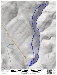
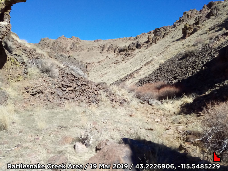
(March 21, 2019 / Author: Tim Bondy) This cross country hike started near Idaho’s Highway 20 and Rattlesnake Creek outside the tiny town of Mountain Home. Because I was shed hunting, I ended up hiking a much steeper route, in places, than if I was just out for peak bagging or basic exploring. I was surprised to see a number of game/cattle trails along my route. In any case, this area is very scenic, rugged and well worth a look if have the time.
Featured Image Info: 43.2226906, -115.5485229 / https://photos.app.goo.gl/Mhv9YtEWxM1uZrAr7
About the Hike
I hiked in the Rattlesnake Creek area before but this hike was different and I think more enjoyable. First off, I’m unsure the canyon I followed was Rattlesnake Creek but I’m sticking to that name. There was an abundance of elk/deer droppings for most of the 3.27 mile loop meaning there should have been some antler sheds. I didn’t find any. There was also an abundance of bones out there. I suspect mainly deer or elk but some were likely cow bones also.
This hike started by climbing a rather steep grade immediately adjacent to the highway. Once on top of that minor peak, the views opened up. But, what goes up must come down and I transitioned down to a saddle and headed back up towards another peak/butte.
This part of the hike was where I picked up a well-worn trail. I assume cattle/game trail? Something to note … One is never very far from a cow patty when hiking in the area I tread upon on this hike. In places, there’s is copious amounts of cow patties. The trail is also carved into the side of a rather steep grade down into the canyon. The views are nice along that section.
Eventually, I had a choice of turning around or heading down a steep grade into the Rattlesnake Creek canyon. I went downhill and I’m glad I did. The creek, on this day, was the very definition of intermittent. Again, the signs of elk and deer were everywhere.
“I enjoyed this hike much more than past hikes on the Teapot Dome side of the creek.” ~ Tim Bondy
Rattlesnake Creek Area Hiking Trip Report
- Adventure Date: 19 Mar 2019
- Consider Doing it Again?: Yes
- Trailhead: 43.206858, -115.555462
- Trailhead Temperature: 59°F
- Turn-Around Point or Furthest Out Point: 43.223318, -115.549034
- 7.5 Topo Maps: “Teapot Dome”
- Trail/Road #: None, 100% cross country hike
- Land Ownership: 100% public BLM lands
- Mileage: 3.27 miles
- +Vertical Feet: 1,130 feet
- Avg Slope from Google Earth Vertical Profile of the GPX File: 15.2%
- Health of Local Environment – [Excellent / Good / Fair / Bad / Horrible]: Bad, for abundant cow patties and trash
- Wildlife: A few mule deer, two very large marmots and also a lot of songbirds (non-raptor type). The number of songbirds was unusual. There were a huge amount of deer/elk droppings along most of the route.
- Google Photo Album Link: https://photos.app.goo.gl/kFUPc5VP4ybBgvwH8
- KML/KMZ File: Part of the “Antler Shed Hunt 2019.kmz” file (local file only)
- GPX File Name: 20190319-134050.gpx (local file only)
- Google Map Link on the Route: https://goo.gl/maps/XEZp8stjWbF2
- Driving Time to Trailhead: 20 minutes

Originally published on 21 Mar 2019
Thanks,
~ signed ~
Tim Bondy
Freelance Writer & Citizen Journalist
“Look deep into nature and you will understand everything better.” ~ Albert Einstein?

