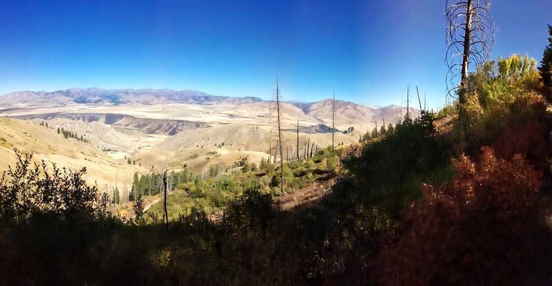
This is a trip report from a September 25, 2018 mountain bike ride heading toward the Danskin Lookout in southern Idaho.
Link to Photo: https://photos.app.goo.gl/WgU4gSUYphxXUoyu8
Biking, Hikes and Fish Idaho
By Tim Bondy
Last updated on January 26, 2019
Introduction to the “Case Creek to Danskin Outlook Peak”
This ride is a strenuous and high vertical footage adventure. With an average slope greater than 7% to get to the Danskin Lookout, peaking out will be an accomplishment for me. And not peaking out is also okay with me. On this 25 Sept. 2018 ride, I made it further and higher than ever before. I’m either getting in better shape or learning to be a more efficient rider.
Pro’s: The scenery in the high country. Being higher in elevation the ride can be done during the heat of summer. The Challenge!
Con’s: Cattle and private property. Lots of Mormon crickets. Rough drive to the trailhead.
Case Creek to Danskin Outlook Peak Trip Report Basic/Stats
Adventure Date: 25 Sept. 2018
Consider Doing it Again?: Yes
Trailhead: 43.425060, -115.737425
Turn-Around Point or Furthest Out Point: 43.417731, -115.656007
7.5 Topo Maps: Danskin Peak, but “The Roost” for other rides in the area too
Trail/Road #: #167-Danskin Lookout Road
Land Ownership: The road (BLM Road #167) is maintained by Elmore County from Foothill Road to the Lookout tower/summit. Staying on #167 is legal. However, the dirt road does transit through a significant portion of private property mainly in the higher elevations. So going off-road and hiking would be considered trespassing.
Mileage: 13.3 miles
+Vertical Feet: 2,157 feet
Avg Slope from Google Earth Vertical Profile of the GPX File: 5.6%
Google Photo Album Link: https://photos.app.goo.gl/BUsBaGdJn1WpwZBW6
Google Earth KMZ: DANSKIN – Bike – Case Creek to Danskin Outlook Peak.kmz
GPX File Name: 20180925-130014.gpx
Driving Time to Trailhead: Only 24 miles but a rough 1:10 hr drive
Summary of Ride: This weekday attempt to peak out on Danskin Lookout was quite enjoyable. Starting at the Case Creek trailhead parking lot and heading steadily upward I finally broke out of the five miles out and back mode.
The views of the Boise Mountains and Prairie flats from the higher elevations are awesome. Because this was hunting (bow hunting) season there was more vehicle traffic than normal but I believe only 4 trucks total. There was also some good fall colors going on during this ride.
I came up about 1 mile short of the summit but that is a steep 1 mile so the next few times heading up this direction will still be an extreme challenge.
Originally published on January 26, 2019
Sincerely,
~ signed ~
Tim Bondy – Freelance Writer

