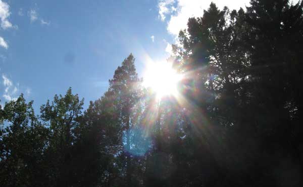
Excellent scenery, solitude and surprises along Soldier Creek highlighted this hike in the Sawtooth National Forest on NFS Trail 005. And the drive from Mountain Home to the Fairfield, Idaho area was relatively short with only a few minutes of gravel road driving.
NFS Trail 005 at a Glance
View Larger Map
- The trailhead is at 43.498638, -114.834533 but I parked 0.8 miles south of it in the Pioneer Campground.
- This hike was an out and back type but for the overly ambitious, a long loop could be planned.
- The trail follows the North Fork of Soldier Creek.
- This is a hiking, horseback riding and mountain biking trail only. In other words, no motor vehicles.
- The North Fork and I suspect the South Fork of Soldier Creek was flowing rather nicely for the beginning of October 2011.
| From Hike Along North Fork of Soldier Creek near Fairfield Idaho in October 2011 |
The Hike
The hike starts near Soldier Mountain Ski Area and heads almost straight north into the Sawtooth National Forest. As anyone who has been in this area before you know the mountains are about 80% sagebrush covered hillsides and 20% pine and deciduous forest. Because NFS Trail 005 follows Soldier Creek, most of the hike is through forested area.
The trail gradually climbs in elevation and my GPS data indicated the average slope was a steady 7%. Of course there are short stretches where the trail is steeper but nothing most people couldn’t easily handle. The trail itself is in very good shape and easily followed but this is ranching country so expect a few (or a lot) cow patties along the way.
| From Hike Along North Fork of Soldier Creek near Fairfield Idaho in October 2011 |
As a general rule, the hillsides on the east side of the trail are wide open with scattered stands of aspen, pines and other trees. The hillsides on the west side of the trail appeared steeper and tree covered most of the way. This contrast is what made this one of the most enjoyable hikes I’ve taken.
| From Hike Along North Fork of Soldier Creek near Fairfield Idaho in October 2011 |
While my hike mileage totaled only about 7.5 miles I didn’t make it to my planned destination. My plan was to head out to where the trails turns straight west towards the headwaters of the North Fork of Soldier Creek and what I hoped would be a good rock hounding spot. I never even made it to the spot where the trail turned west though.
The Surprises Encountered on This Hike
– I encountered 2 beaver dams on Soldier Creek. There is a healthy population of beavers if the amount of downed trees is any indication.
| From Hike Along North Fork of Soldier Creek near Fairfield Idaho in October 2011 |
– This semi-short hike would make an excellent camping area. There are a ton of flat creekside places just begging to have a tent set up on them. There is an abundance of firewood and Soldier Creek gives you a source of water if you have a good filtration system.
– Obviously this creek supports a large number of deer and elk. This valley seems like a good spot for moose to call home. I didn’t see any animals except a large number of chipmunks and birds though.
| From Hike Along North Fork of Soldier Creek near Fairfield Idaho in October 2011 |
– I suspect wolves have been recent visitors to this area. I encountered what I think was wolf scat that appeared rather fresh. And there were a few sections of the trail where my dog was as spooked as I’ve ever seen her. I had to put a leash on Addie just so she would continue up the trail. Once the leash was on she was more than happy to continue on…and pull me up some steep sections 🙂
– This trail seems like it gets some heavy weekend traffic during the summer but it’s not the typical hiking trail. There are 3 creek crossings where your only option is to rock hop across. On 2 of the crossing there really was no way to stay dry even this late into the “dry season”.
| From Hike Along North Fork of Soldier Creek near Fairfield Idaho in October 2011 |
North Fork of Soldier Creek Hike Stats
- Total Distance: 7.63 miles
- Elevation Gain/Loss: 1,740 feet
- Time on the trail: 4 hours 45 minute
- Elevation Spread: 5,850ft to 7,024ft
- Road Miles from Mountain Home: About 70 miles or 1 hour 20 minutes in the car.
| From Hike Along North Fork of Soldier Creek near Fairfield Idaho in October 2011 |
Overall, this hike was one of my most enjoyable hikes ever. The scenery, when it opens up over the sagebrush hillside, is spectacular. If I had taken this hike a few days later in October, the many aspen tree groves would likely have been much more colorful. Encountering the beaver dams was a big plus. I will plan a trip up the South Fork of Soldier Creek soon. With plenty of water for my dog (wet weather is coming too), a more direct route into the mountains where I suspect the Idaho Batholith is exposed for some rock hounding and the a better chance for some Fall Colors make this especially appealing.
Comments
Hope you enjoyed this article. It getting late in the season so if you are going to head out to the higher elevation like the Soldier Creek area it better be soon. This might be a fun snowshoe adventure later in the season. Leave me a comment if you like. I’d like to hear from you.


