(March 25, 2019 / Author: Tim Bondy) This hike is located just above the South Fork of the Boise River, east of the Pierce Creek drainage and FSR #121 as it heads up to Prairie, Idaho. The hike provides great scenery along ridgelines that few people have been. This was one of the most strenuous hikes I’ve taken on, ever.
Introduction to “Hike Towards Peak 6591” Near Prairie Road (FSR #121)
Pros: The scenery and the challenge!
Cons: The ground on route up can be extremely loose and soft. I got lucky hiking the route I took up. I encountered some very loose and soft soil on the way down that would have been misery to scramble up. In places, the grade is extremely steep.
Hike Towards Peak 6591 Trip Report Basic/Stats
- Adventure Date: October 8, 2018
- Consider Doing it Again?: Yes
- Trailhead: 1-hour drive at 43.402918, -115.559973
- Turn-Around Point or Furthest Out Point: 43.407222, -115.537547
- 7.5 Topo Maps: Cathedral Rocks
- Trail/Road #: Trailhead off FSR #121 or the South Fork of the Boise River Road
- Mountain Range(s) Involved: Danskin Mountains? The Boise Mountain? To me, I’m calling them the Fall Creek Mountains (Self-named)
- : Environment statement – Bad for cheatgrass
- Land Ownership: Bureau of Reclamation near the trailhead and then all National Forest Service
- Wildlife: Deer in the distance
- Mileage: 3 miles
- +Vertical Feet: 2,057 feet
- Avg Slope from Google Earth Vertical Profile of the GPX File: 24.5%
- Google Photo Album Link: https://photos.app.goo.gl/uSkpY7juzZELZY6j8
- Google Earth KMZ: SOUTHFORK – Hike – Peak 6591 (local file only)
- GPX File Name: 20181008-125804.gpx (local file only)
- Driving Time to Trailhead: 1 hour or 29 miles
- Peak 6591: 43.402481, -115.521757
Summary of Hike
Most of the hike is covered by cheatgrass. I had to throw away my socks from this hike as the cheatgrass permeated and encrusted them.
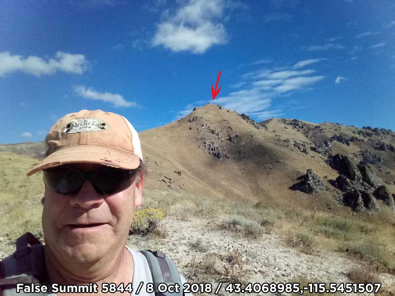
I didn’t even get close to summiting Peak 6591 on this first attempt. It’s steep even when “walking” from ridgeline to ridgeline. I’m getting much more comfortable with my fear of falling off the earth while hiking steep slopes but some portions of this hike that fear came rushing back. Did I mention the hike was steep?
I wouldn’t expect to find any other backcountry sportsmen is this specific area once you get 1 mile in. Upland bird hunters obviously frequent the lower slope along my hike as shotgun shells were a common find.
I ended up 1 mile and 900 vertical feet short of my goal, Peak 6591. If I had “summited” the stats would have been 5 miles and 3,000 vertical gain.
If attempting this hike, do it once you have worked yourself into good shape. I was in pretty good shape and my legs hurt for days.
Topo Map With GPX Track Overlay
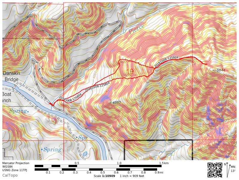
Click for larger version of the GPX track.
This story was originally posted on the website on March 25, 2019, but first published on December 14, 2018, at https://timbondy.blogspot.com/
Thanks,
~ signed ~
Tim Bondy
Freelance Writer & Citizen Journalist