
(March 11, 2019 / Author: Tim Bondy) This cross country hike on the flanks of Granite Mountain in the Boise Mountains or what I call the “Fall Creek Mountains” has become a sort of obsession to me. The 6,818 foot tall (or 7,084ft) peak looks close enough but it’s a strenuous hike starting at the banks of the South Fork of the Boise River in Idaho, USA.
Note: A version of this trip report was originally published on another website. I decided to significantly modify it and republish the story right here.
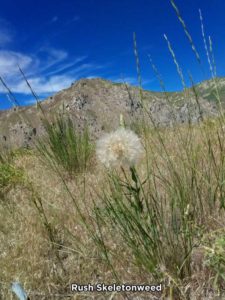
Featured image was taken at 43.3739548, -115.5192337 and a larger version can be seen at https://photos.app.goo.gl/vnBp56fp3CDoi3tp7
This June 14, 2018, cross country hike was my second attempt to stand on the summit of Granite Mountain (43.375007, -115.499462 / 6818 feet). It’s a strenuous hike for me and probably for many people in my age and weight class. The scenery is the reason I will continue to hike this “non-pathed” route again and again. That, and it’s close to home.
The views from my turnaround point were pretty amazing. I could easily pick out mountain peaks in the Owyhee Mountains, 65 miles to the southwest and Bogus Basin 40 miles to the northwest. There were also other closer recognizable peaks and geologic features visible.
Stats From the Granite Mountain Hike
- Adventure Date: 14 June 2018
- Consider Doing it Again?: Yes
- Trailhead: 43.352455, -115.534480
- Turn-Around Point or Furthest Out Point: 43.373352, -115.5199738
- 7.5 Topo Maps: Long Tom Reservoir, Cathedral Rocks, House Mountain & Anderson Ranch Dam
- Trail/Road #: This was a cross country hike so there are no trail or road numbers
- Land Ownership: 100% U.S. Forest Service
- Mileage: 3.66 miles
- +Vertical Feet: 2,211 feet
- Avg Slope from Google Earth Vertical Profile of the GPX File: 24.4%
- Google Photo Album Link: https://photos.app.goo.gl/QR1DqrpFNycwWLxQ6
- Google Earth KMZ: SOUTH FORK – Hike – Granite Peak Attempt.kmz (local file only)
- GPX File Name: 14June2018-Approx-Hike-Path.kml (local file only/gpx problems on this hike)
- Wildlife: Crows, mule deer, and elk
- Driving Time to Trailhead: About 30 miles and a one hour drive time
A trend emerged in 2018. I’m failing to hike/bike to my goal on almost all of my recent adventures in southern Idaho. I’m good with that type of failure. I try to set my goal a little too high or too far as a way to challenge myself. And it’s working.
In reality, to summit out on Granite Mountain, it would have added 2.5 miles and about 1,050 vertical feet to the hike. That’s a challenge I hope to meet in the coming years.
Last updated on March 11, 2019.
~ signed ~
Tim Bondy
Freelance Writer & Citizen Journalist
“Life begins at the end of your comfort zone.” ~ Neale Donald Walsch