(February 25, 2019 / Author: Tim Bondy) This October 30, 2018, hike in the Danskin Mountains of southwestern Idaho, USA, is a favorite of mine. It’s strenuous and it affords sweeping views of the Boise Mountains, Owyhee Mountains, and even the Trinity Mountains. On a clear day, you can see 90+ miles. This is a 100% cross country hike.
Link to featured image: https://photos.app.goo.gl/5QRbVhbFUV1WPuhK8
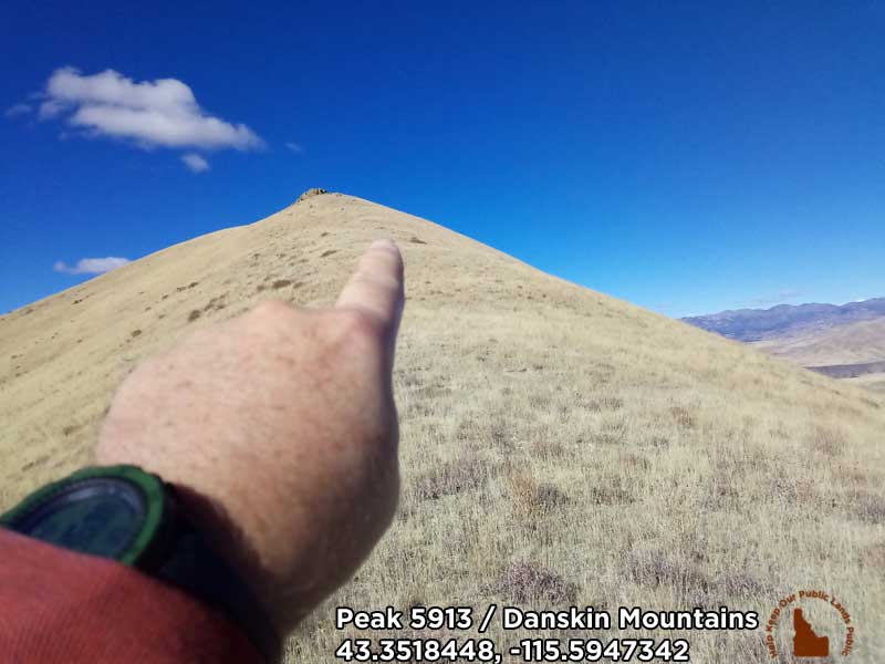
What About the Hike to Peak 5913 in Idaho’s Danskin Mountains
This hike is strenuous. It begins on a gravel road above the South Fork of the Boise River and heads up ridgeline after ridgeline with Peak 5913 only two miles from that trailhead. It’s the steepness that makes this cross country hike a challenge.
This Danskin Mountains hike has become a favorite because the trailhead is relatively close to home and the outstanding scenery with sweeping views of the Boise Mountains, Prairie, Idaho area mountains and Fall Creek Mountains to the north.
This was the fifth time I’ve attempted to summit out on the peak but I ended up about 1,400 feet and 300 vertical feet short of that goal. As I topped out on a saddle just below the summit I saw a hunter pacing around the huge rock near the summit. The hunter obviously didn’t want me molesting his hunt and I didn’t. As a matter of fact, I saw a number of hunters in the area during this hike. The last days of elk hunting season is not a great time for hiking in this area … Just saying.
Pros: The challenge. The scenery.
Cons: The cheatgrass.
Info and Stats – Peak 5913 Hike
- Adventure Date: October 30, 2018
- Consider Doing it Again?: Yes
- Trailhead: 43.342045, -115.567314
- Turn-Around Point or Furthest Out Point: 43.351861, -115.594745
- 7.5 Topo Maps: “Long Tom Reservoir”
- Trail/Road #: None – This is a cross-country hike
- Land Ownership: A vast majority of the hike is on U.S. Forest Service land but there is a little BLM and Idaho State lands also involved. No private property was crossed on this hike.
- Mileage: 3.78 miles
- +Vertical Feet: 1,938 feet
- Avg Slope from Google Earth Vertical Profile of the GPX File: 18.9%
- Google Photo Album Link: https://photos.app.goo.gl/Hq9BZmMSRvsTX5CC9
- Google Earth KMZ: DANSKIN – Hike – Peak 5913 Oasis Hike or Triangle Peak (local file only)
- GPX File Name: 20181030-130637.gpx (local file only)
- Driving Time to Trailhead: 35 minutes to a safe place to park
Other Information
Just two questions for my Idaho District 23 representatives and senator … who owns the land I’m standing on in the photo and would you like me to mail you some of the cow shit seen in the photo. Don’t answer those question because we all know you don’t care about anyone other than private landowners.
Originally posted at Tim Bondy Writes (https://timbondy.blogspot.com/) on January 15, 2019
Thanks,
~ signed ~
Tim Bondy
Freelance Writer & Citizen Journalist
.
I am a proud citizen journalist, aka “enemy of the American People!”