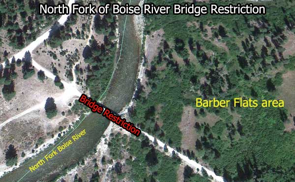
The bridge across the North Fork of the Boise River at Barber Flats has new restrictions on what types of vehicles can cross it. The Boise National Forest issued the restriction order on April 27, 2012. The date when the bridge will be repaired has yet to be determined.
Barber Flats Bridge Restriction Information
- Location: On the North Fork of the Boise River at coordinates 43.809076, -115.536255
- Bridge Restricted to vehicles 50 inches wide or LESS. Basically ATV and smaller vehicles will be able to use this bridge.
- NFS Restriction Order Number: 0402-03-40
- Link to the “Order”: http://www.fs.usda.gov/Internet/FSE_DOCUMENTS/stelprdb5365459.pdf
- Link to the official story: http://www.fs.usda.gov/detail/boise/news-events/?cid=STELPRDB5365922
- Link to map of bridge: http://maps.google.com/maps/ms?msid=217923343964080707607.0004bf278d1095a3ac66d&msa=0&ll=43.808022,-115.544415&spn=0.024095,0.055661
Interactive Map of the Area
View Larger Map
Comments
Hope this information is useful to a few people out there. I’d hate to get all the way out to the Middle Fork only to discover I couldn’t drive my truck over the Barber Flats Bridge and along the North Fork of the Boise River. Leave a comment if you wish.
Thanks,


