
(January 29th, 2012) Needing to get out of the house, I planned a short trip in the Bennett Mountain Road area north of Glenns Ferry. The snow level was a concern as it would determine which path I would take. With 3 plans mapped out, Addie, my dog and I headed up to “the hills”.

Ron Paul Makes Hiking Option “A” is a No-Go
My first plan was to hike straight west along the “Bennett Hill Front” where I suspected the snow would be gone. The drive up the paved part of this road had me excited. I could see that the route Plan A would follow was basically snow free. I headed up to the paved parking area on Bennett Mountain Road but encountered a hunter with dogs just getting ready to head out in the direction of my hike.
I chatted with this gentleman and indeed he was going hunting along my planned route. Not a problem for me except…This hunter looked and sounded exactly like the Presidential Candidate Ron Paul. It wasn’t Ron Paul, or was it?

Plan B Option has a Barrier
Plan B was to drive about 1 mile past the paved parking lot, park and hike along a creekbed to the west.
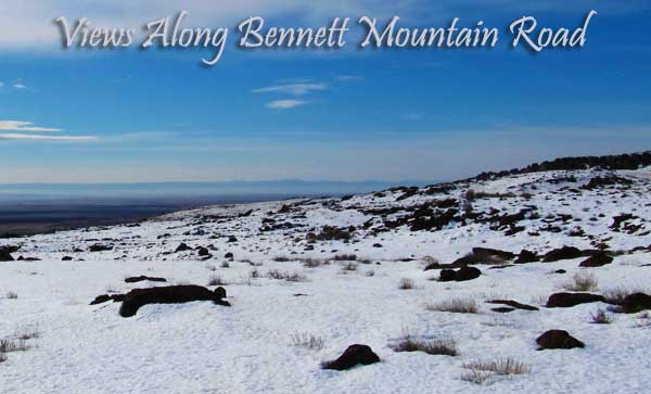
As you can see from the picture above, the road was closed by snow. So I decided this was more ambitious than I wanted to get. Hiking 1 mile on Bennett Mountain Road and a few miles off-trail in 6-12 inches of crusty snow did not sound like fun. And if it’s not fun why hike it? Plan B was a no-go.
Plan C is the Only Option
Plan C was the simplest and most flexible plan. That is, just walking along Bennett Mountain Road. And that’s what we did. It was a nice 3.2 mile hike along Babb Flats. The road, as I mention was closed to cars and trucks but open to snowmobiles. I really enjoyed this walk in bright sunshine and warm temperatures. Bennett Mountain Road has become one of my “go to” places because of the easy access and scenic aspects.
Snow Levels At?
The snow level on January 29th, 2012 was approximately 4,400 feet give or take a dozen or so feet. I’d say the average snow pack was about 8 inches along the way.

Backcountry Skiing Possibilities
I’ve never really thought about backcountry skiing but it seems like Bennett Mountain Road could provide some excellent places to ski. A lot of the hillsides are treeless and the hike/ski/snowmobile into these peaks wouldn’t be all that bad for the person in good shape.
Thanks for Reading!
